Indian Space Research Organisation recently released a new set of images of the moon’s surface as captured by Chandrayaan – 2. These images are 3D images that showcase the various elements on the moon’s surface.
What are these images?
According to ISRO official twitter handle post, these images are a 3D view of the surface element. These images were captured by the Terrain Mapping Camera-2 (TMC-2), which is being used on the orbiter. TMC – 2 has the capacity of providing at 5m spatial resolution & stereo triplets (fore, nadir, and aft views). These are processed to create DEM images of the complete lunar surface.
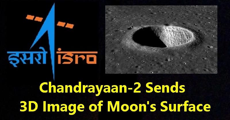
Image via ISRO
After processing the images into DEM (digital elevation model), you get a 3D CG representation of a terrain surface. You can see the various landform, shapes, and structures of the moon surface.
What are these images useful for?
#ISRO Have a look of 3D view of a crater imaged by TMC-2 of #Chandrayaan2 . TMC-2 provides images at 5m spatial resolution & stereo triplets (fore, nadir and aft views) for preparing DEM of the complete lunar surface. For more details visit https://t.co/urlZqzg3Gw pic.twitter.com/VBvUeH1L8s — ISRO (@isro) November 13, 2019
